
The land is still dark, but city and road lights form a luminous web. A thin band of brightness has appeared at Earth's edge. In NASA's November 5 Image of the Day, dawn is approaching a view photographed from the International Space Station by Canadian astronaut Joshua Kutryk.
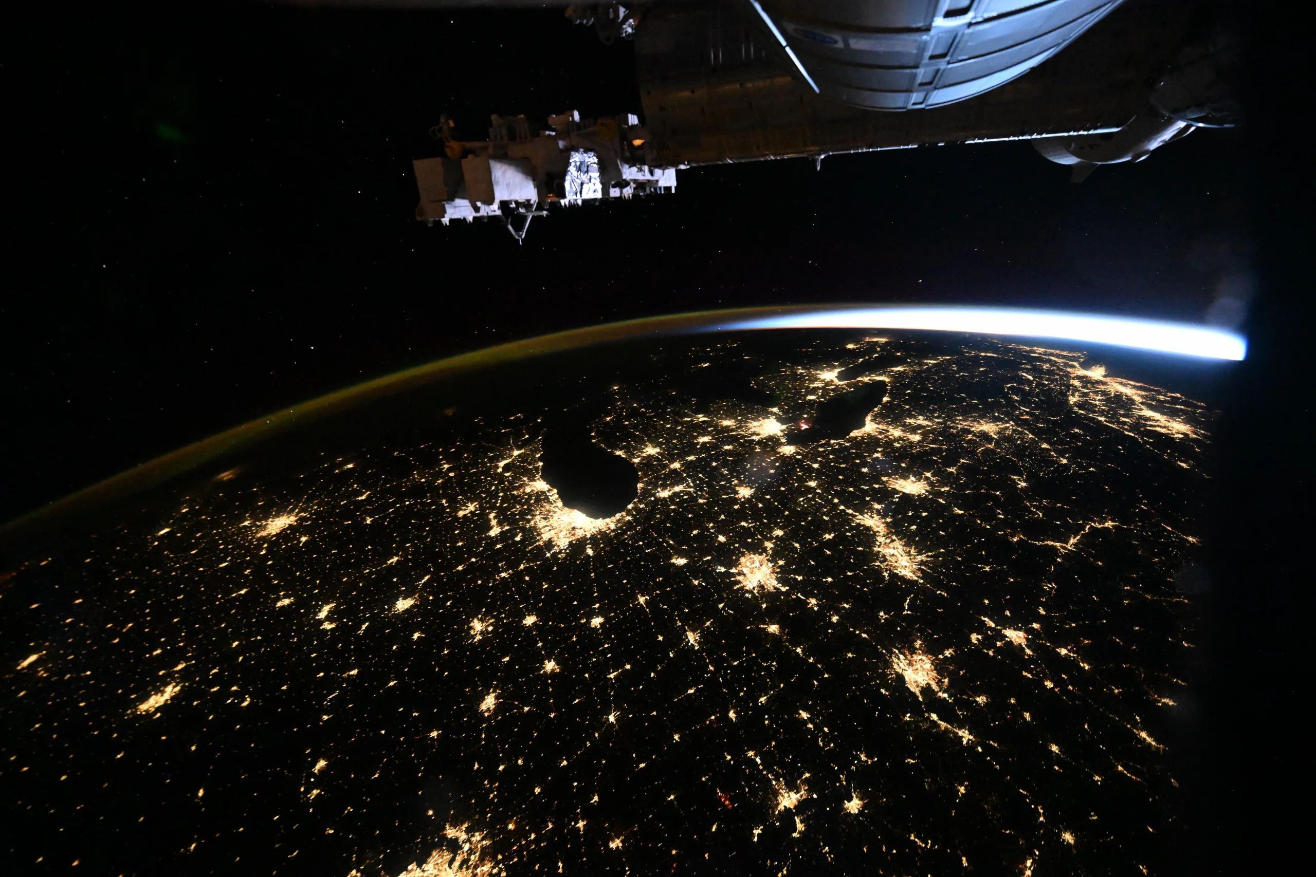
Image: NASA Image of the Day · Image credit: CSA/Joshua Kutryk · Original page
Kutryk took the photograph on October 18, 2026, before its November 5 publication. The station was about 259 miles, or 417 kilometers, above Earth. NASA says the view stretches from the American Midwest toward the East Coast and includes the Chicago, Detroit and New York metropolitan areas.
Those lights are not a map drawn along state borders. Populated places, roads and the ways people use electricity create the bright clusters and connecting lines. In its account of a night view from the same date, NASA's Earth Observatory also identifies airglow and pre-sunrise light near the horizon. Dark ground and a brightening sky can therefore share the same frame.
Compare the photograph with a night map of the Great Lakes, Chicago and the East Coast. Find the geographic shapes first; only then try identifying the light clusters. That is more reliable than guessing which individual light belongs to which city.