
Sunset catches two towers. The nearer one has weathered stone walls and stands on a rocky headland. The farther one gleams white on an island summit. Blue water lies between them.
This is the Sanguinaires archipelago off Corsica, France: four small islands at the entrance to the Gulf of Ajaccio. The towers were built almost three centuries apart and served different purposes. One watched to see who was coming by sea. The other made itself recognizable to sailors.
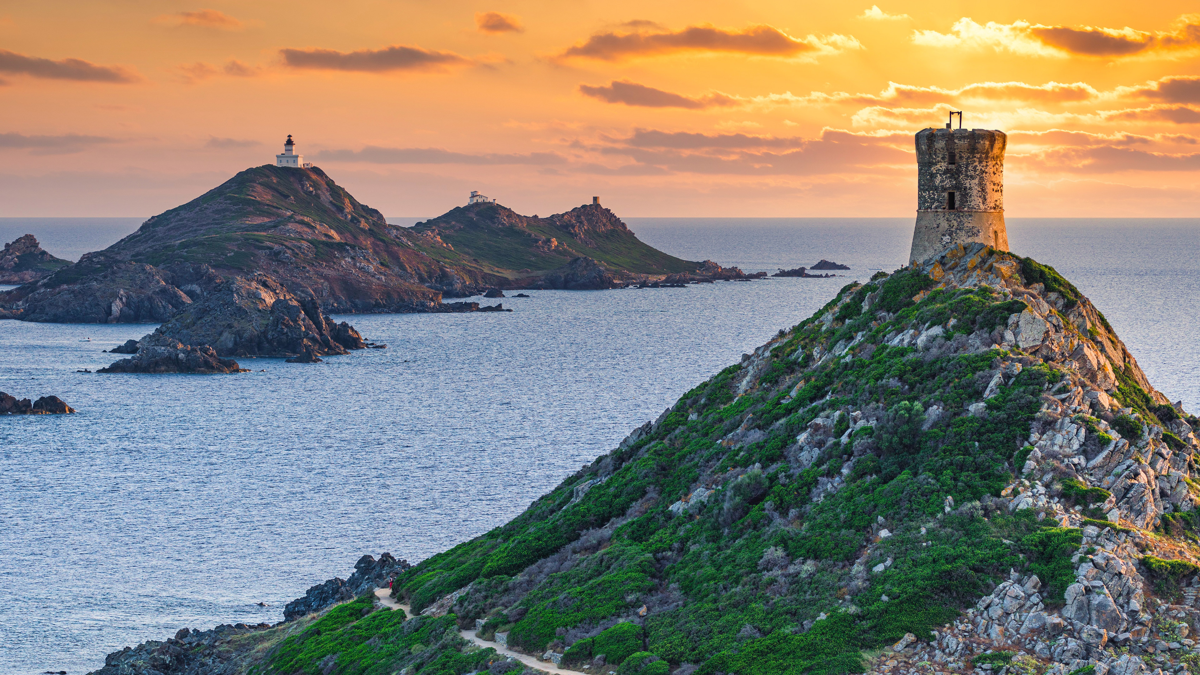
Image: Sanguinaires archipelago, seen from Corsica, France | © Francesco Riccardo Iacomino/Getty Images | Original page.
A Tower That Watched for Ships
The round tower on the right is the Parata tower, built in 1550-1551. The Genoese constructed coastal watchtowers around Corsica to guard against attacks from the sea. Parata belonged to a defensive network of 90 towers.
Three men staffed it: a leader and two soldiers. The rooftop served as a lookout and defensive platform, with a hearth that could produce smoke signals. Height gave them an earlier view of approaching ships. A signal gave people ashore more time to prepare.
Watching was only part of the job. Beneath the tower's two interior levels, a cistern collected rainwater draining from the roof. A sunbaked, windswept outpost first had to keep its occupants supplied with water. That small arrangement inside the stone walls makes the watchmen's daily lives easier to imagine.
A Tower That Ships Could Recognize
On the island to the left, the white building is the Sanguinaires lighthouse on Mezu Mare. It entered service in 1844, helping ships establish their position.
From here it looks like a small white mark on a hill. Building it took six years. Stone arrived by barge, then traveled inland on donkeys. A clear landmark on a nautical chart had to be assembled one cargo and one uphill journey at a time.
The tower itself is about 18 meters tall, while its light stands roughly 98 meters above sea level. The island does much of the lifting.
Sailors also need to identify which light they are seeing. A lighthouse's flash pattern supplies a clue recorded in navigational references. The site's educational guide lists three white flashes in each 15-second cycle for this lighthouse. Count the beats, then compare them with a light list, and a point of light acquires a name.
Three keepers once took turns here. The light was automated in 1984, and staffing ended the following year. Their shifts were no longer needed to keep it running.
Home from the Sea, but Still Waiting
Below the lighthouse are the remains of a place devoted to a slower kind of waiting.
A quarantine station was built in 1806-1807 for fishermen returning from coral-gathering voyages. It could accommodate as many as 80 small coral boats. The boats were hauled along large wooden beams into the enclosure, raised and secured. Several fishermen lived together in each boat, now out of the water, in rudimentary and unsanitary conditions.
They had returned, but could not immediately go back to port. Forty days of observation followed, overseen by an administrator, surgeon, nurse and health inspector checking for infectious disease. Between 1807 and 1847, the station operated for a cumulative nine years.
For the watchtower, an approaching ship might mean danger. For the lighthouse, a ship needed a recognizable position. At the quarantine station, the vessel was already ashore, but its occupants still had to wait. Today's landscape photograph gathers places that once dealt with very practical questions about people at sea.
A Red Sunset, an Uncertain Name
The islands' sunset colors often feature in explanations of their name, which evokes blood: rocks turn reddish in the evening light, and a memorable name follows.
Sunset and plant colors have both been proposed. Another clue points toward the Gulf of Sagone to the north. Some 17th-century maps labeled the islands "sagonare insulae." The name may have changed as it passed between speakers. Its precise origin remains unsettled.
The photograph certainly shows warm light on sky and rock. It cannot tell us why someone named these islands centuries ago.
If you reach Ajaccio, marked paths on the Parata peninsula lead to the tower's base; its interior is closed to visitors. Reaching Mezu Mare requires a boat.
For now, enlarge the picture. Follow the small path around the rock at lower right, then examine the distant lighthouse's base. It replaced an earlier Genoese tower on the island, and its castle-like foundation recalls the older coastal lookout.