
The trees are silhouettes and the field is fading into darkness, but a silver-blue mesh still hangs across the sky. Darker clouds obscure parts of it. Night seems to have reached the ground before it reached the shining layer overhead.
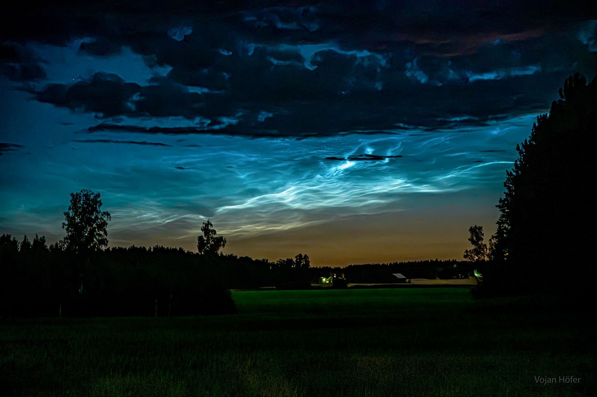
Image: NASA Astronomy Picture of the Day. Credit & Copyright: V. Höfer, D. Večerník & B. Večerníková. Original page.
The October 27 APOD features noctilucent clouds photographed near Linköping, Sweden, in early August. The publication date is separate from the season pictured; this is not a forecast for tonight.
Sunset Arrives at Different Heights
Noctilucent clouds scatter sunlight. When an observer on the ground has entered Earth's shadow, a sufficiently high cloud can still catch the Sun. Ordinary lower clouds have already darkened while the much higher layer remains illuminated. The photograph makes that difference visible.
The World Meteorological Organization's cloud atlas describes these clouds as tiny water-ice crystals. A NASA satellite account places them just over 80 kilometers above the surface, in the mesosphere, far above the troposphere where everyday weather unfolds. Water vapor freezes around tiny particles that can serve as starting points for the crystals.
Why an Ice Cloud Favors Summer
Warm ground does not guarantee warm air at every height. NASA explains that air in the polar mesosphere rises in summer and descends in winter. Rising air cools, making summer colder than winter at this altitude. With suitable water vapor, dust, and extremely low temperatures, ice crystals can form.
NASA's AIM mission detected meteoritic material within noctilucent-cloud ice. Tiny particles left by material entering our atmosphere from space can take part in building the clouds. Their beginnings are far too small to distinguish with the naked eye.
One sighting cannot diagnose a local change in climate. Temperature, moisture, circulation, and viewing conditions all matter. Long-term change requires sustained measurement.
The Royal Observatory Greenwich's observing guide gives a usual viewing range of roughly 45 to 80 degrees north or south. The northern season runs from late May to early August, with June and July more favorable. Southern sightings are rarer, with a season extending approximately from late November to early February. These are useful ranges for seeking an opportunity, not guarantees or absolute boundaries.
For a visit to higher northern latitudes, save the idea for late spring or summer twilight. Choose an open horizon with little low cloud, and look for delicate silver-blue ripples after sunset or before sunrise. Compare them with nearby ordinary clouds. A layer that stays bright while other clouds turn dark gives you a better question to investigate than color alone. An October photograph can become a clue for next summer's skywatching.