
The color of this river begins with rock ground beneath moving ice.
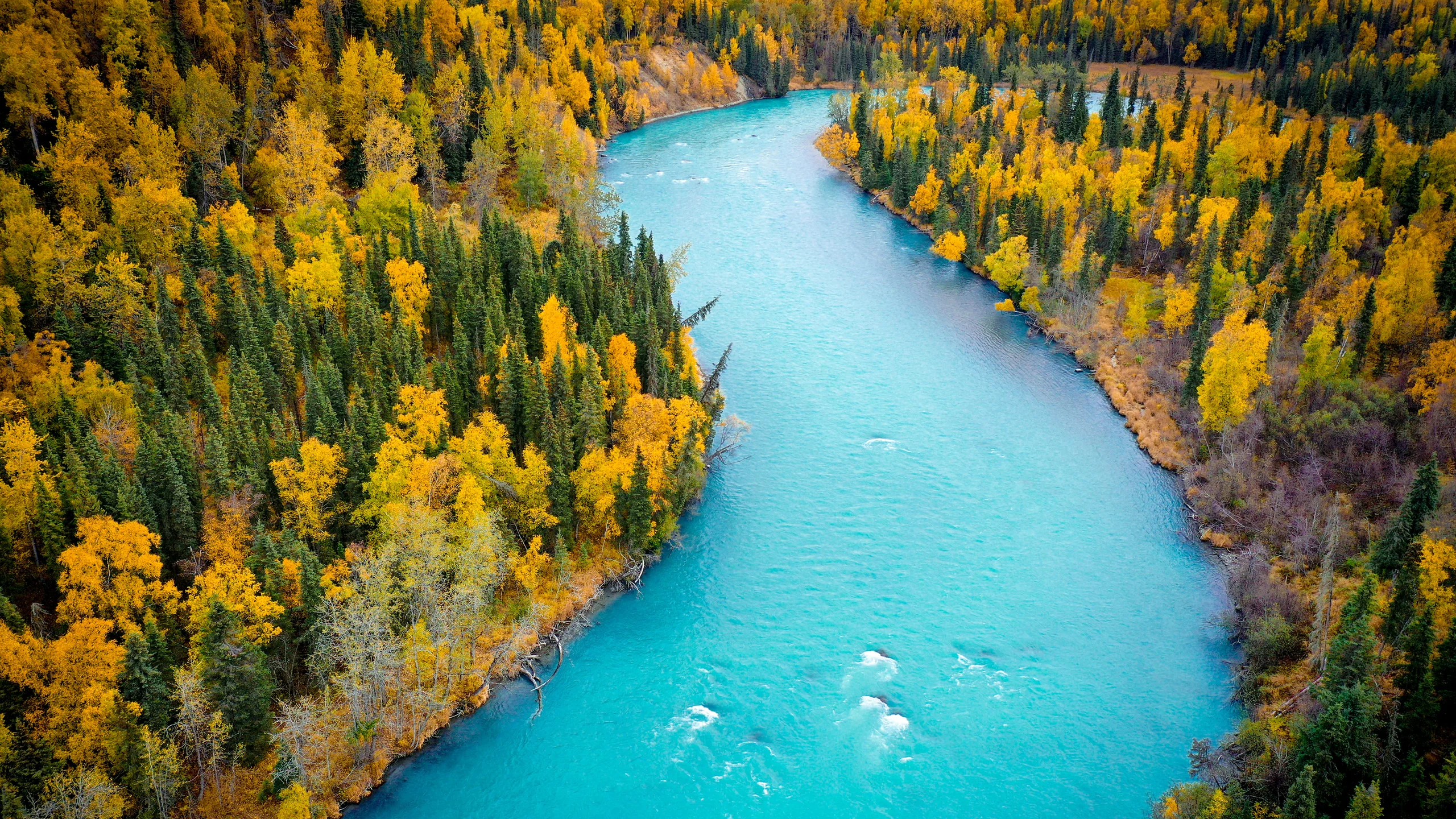
Image: Bing Wallpaper | Kasilof River, Alaska, United States | Copyright: jared lloyd/Getty Images | Original page
The river in Bing's September 29 wallpaper looks almost artificially colored. Its blue is opaque and milky, quite unlike the dark blue of deep, clear water.
This is the Kasilof River on Alaska's Kenai Peninsula. It runs roughly 30 kilometers from Tustumena Lake to Cook Inlet. Upstream, meltwater from Tustumena Glacier, an extension of the Harding Icefield, supplies the lake with something less obvious than water: finely ground stone.
A Glacier Is Also a Mill
A glacier moves under its own weight. Rock carried at its base scrapes the bed beneath it, while freezing water can help break rock apart. The resulting fine sediment is often called rock flour.
Tiny mineral particles, including quartz and feldspar, can remain suspended for long periods. Meltwater carries them into lakes and rivers, where they scatter incoming light. Water itself absorbs different wavelengths unequally, with red light absorbed more strongly than blue. Together, absorption and scattering help produce the distinctive color; particle size, concentration and the path light takes through the water all matter.
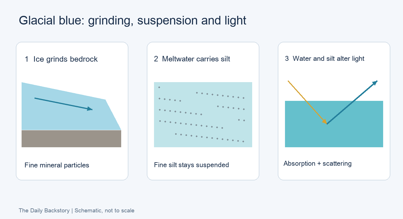
Diagram: The Daily Backstory; schematic, not to scale.
Deep, clear water and a shallow, sediment-rich river can therefore both look blue for different combinations of reasons. In the Kasilof, the suspended particles help return light before it travels far through the water. That gives the river its luminous, cloudy appearance.
When summer melt delivers more sediment, glacial waters can become especially vivid. Changes in sediment supply and settling change the color again.
Beautiful Water, Invisible Fish
The sediment has another consequence. The Kasilof carries returning sockeye salmon, and fisheries managers need estimates of how many reach their spawning grounds. Harvest decisions must leave enough fish to reproduce.
But the river is too turbid for a counting tower to work. At the sonar site, the channel is about 190 feet, or 58 meters, across, too wide for a full weir.
The Alaska Department of Fish and Game instead operates two counting stations on opposite banks, about 7.8 river miles upstream from the mouth, just above the Sterling Highway bridge. Submerged transducers produce acoustic images; timed samples are expanded into estimates of passing fish.
The material that makes the river so photogenic also makes sound more useful than sight.
The department's historical account says that more than 90% of returning sockeye typically enter by August 1. It gives a biological escapement goal of 160,000 to 340,000 fish as of 2011. That is a dated management figure, not the current target.
Three Inventories of Shrinking Ice
The retreat of glaciers is difficult to grasp from one photograph. Repeated inventories make the change measurable.
On March 21, 2025, China's Northwest Institute of Eco-Environment and Resources released the country's third glacier inventory. For conditions around 2020, it counted approximately 69,000 glaciers covering 46,000 square kilometers.
Compared with the first inventory's observations from the 1960s through the 1980s, glacier area had declined by about 26%, and roughly 7,000 small glaciers had disappeared. Compared with the second inventory, representing conditions around 2008, area had fallen by about 6%. The reported rate of area loss increased from about 4.8% per decade over the longer interval to 5.2% per decade over the more recent one.
The new inventory also recorded more than 30,000 remnant ice bodies smaller than 10,000 square meters. Its changing counts reflect both a changing landscape and improved mapping; glacier numbers alone are not a measure of growing ice.
Three inventories turn a slow process into something visible. The bright river downstream is another part of that story: mountain rock, carried away a particle at a time.
Sources
Bing Wallpaper: Original page; Alaska Department of Fish and Game: Kasilof site and river, sonar sampling methods, and fish and historical management figures; Chinese Academy of Sciences: third glacier inventory. Background: Kasilof River, Tustumena Glacier, rock flour, and glacial flour and turquoise lakes.