
For International Geodiversity Day, Bing's Chinese edition turns to Zhangye in Gansu. Reading the stripes means tilting your head, and thinking back to when the layers lay flat.
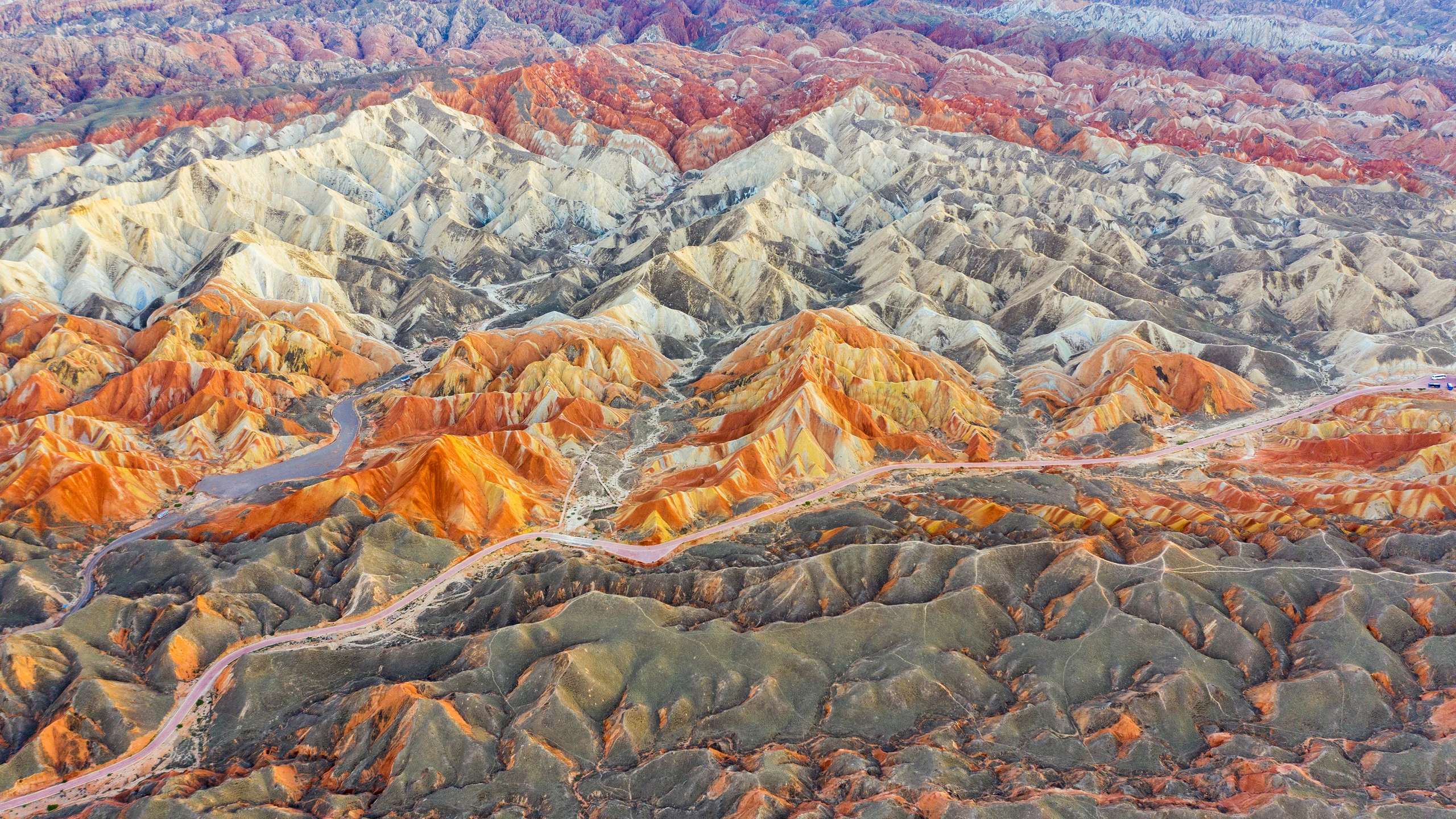
Image: Bing Daily Wallpaper | Copyright: Weiquan Lin/Getty Images | Original page.
Bing calls the photograph a story of Earth written in stripes. The layers do have an order. They simply did not begin at the angle we see today.
Rivers First, Colors Later
China's 2025 World Heritage Tentative List submission places the scenic rocks in the upper member of the Xinminpu Group, about 114 million to 106 million years old. Rivers and lakes left mud, silt and sand that eventually became rock.
The submission describes more than thirty colors. Iron-bearing minerals help explain them: changing oxidizing and reducing conditions affected iron's chemical state, producing oxides, carbonates, sulfides and iron in clay minerals.
The colors are clues to a complicated history. A red band alone cannot identify a particular ancient sunlit riverbank, nor can a green one identify a particular lake bottom. Mineral composition, sedimentary structures and chemistry must be read together.
More Than One Episode of Deformation
The geological sequence is longer than a single collision lifting a flat stack into the air.
Compression had already folded these rocks during the Cretaceous. Later growth of the Tibetan Plateau raised parts of the region again. Wind, water and freeze-thaw weathering helped sculpt the exposed rock into hills.
NASA Earth Observatory identifies the India-Eurasia collision, around fifty million years ago, as an important driver of later deformation. It also notes evidence of rugged terrain predating that collision. Forces from distant plate boundaries can reshape a continent's interior without erasing its earlier history.
A particularly readable clue is the contact between nearly horizontal younger beds and the folded rocks below. Geologists call this an angular unconformity. The lower layers were deformed before the later sediments covered them.
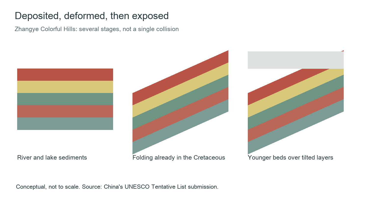
Diagram: The Daily Backstory, based on China's UNESCO Tentative List submission. Conceptual illustration, not to scale.
One tempting calculation does not survive a closer reading. The submission gives nearly 2,500 meters of sedimentary rock for the entire Xinminpu Group in the Minle Basin. The 114-million-to-106-million-year interval applies to its scenic upper member. Dividing the first figure by the second would mix different geological ranges, rather than reveal an annual growth rate.
Colorful Hills and Danxia Are Different Names for Different Things
Tourism often calls the landscape "Seven-Colored Danxia." The formal Tentative List name is Zhangye Colorful Hills.
Here, weakly cemented rocks weather readily into rounded, relatively low hills. The submission distinguishes them from Danxia in their shape, composition, colors and formation. A familiar place-name does not replace a geological description.
The park became a UNESCO Global Geopark in 2020. Its addition to the World Heritage Tentative List in 2025 is a separate step, and does not mean it has been inscribed as a World Heritage site.
More Than a Backdrop for Life
International Geodiversity Day falls on October 6. UNESCO's definition includes Earth's non-living natural variety: minerals, rocks, fossils, soils, landforms and water, along with the processes that create them.
Those last words matter. Geodiversity means more than collecting different kinds of stone. It includes understanding how they arrived here and what changed them.
In Zhangye, color carries clues to chemistry, bedding to deposition, tilted layers to deformation, and the slopes to erosion. The photograph holds several kinds of time at once.
Sources
China's Zhangye Colorful Hills Tentative List submission; NASA Earth Observatory: Red Rocks and Rainbow Ridges; UNESCO: International Geodiversity Day; Zhangye UNESCO Global Geopark: Tentative List announcement.