
What happens to a cave after minerals fill it, erosion exposes it, and people work their way through the ore? A woodland path can pass through several answers at once.
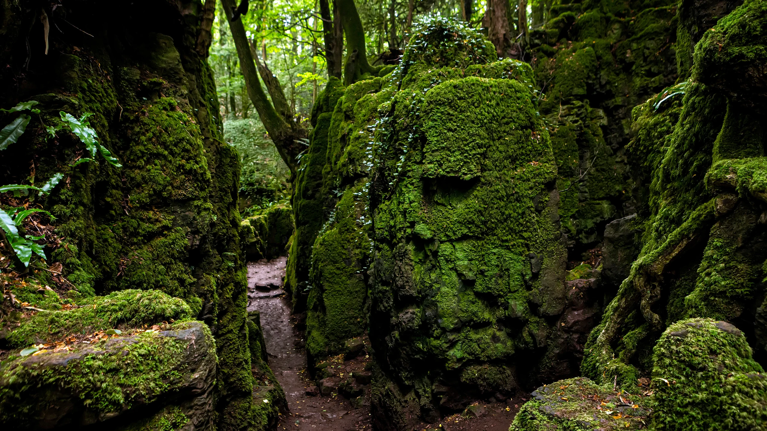
Image: Bing Daily Wallpaper | Puzzlewood, Forest of Dean, Gloucestershire, England | Copyright: Fulcanelli_AOS/Getty Images | Original page.
Bing's Chinese edition for October 7 leads us into a green hollow. Moss covers the rock walls; a path bends between them. This is Puzzlewood, near Coleford in the Forest of Dean.
The intriguing question is who made the hollows. They suggest old mine workings and caves with their roofs removed. Each impression catches part of a much longer story.
Water, Iron and People
These pits, trenches and rocky labyrinths are known locally as scowles. They were traditionally interpreted as early opencast iron workings. Geological and archaeological research has given natural processes a larger role in their history.
Water comes first. Slightly acidic groundwater can dissolve the area's Carboniferous limestone along fractures, developing caves and other voids. This underground sculpting is a familiar part of karst landscapes.
Iron complicates the picture. The British Geological Survey describes Forest of Dean ores in irregular pockets, lodes and veins, partly replacing the limestone. Descending iron-bearing solutions deposited minerals in the rock. Its regional account identifies weathering of iron-bearing minerals in Coal Measures shales as an apparent source of the iron.
A space underground can become solid again. Uplift and erosion then bring buried structures toward the surface. People follow the ore, remove it, and alter the shape of the existing cavities.
Puzzlewood's own history places iron extraction here in the Iron Age and Roman period. The archaeology is less precise about when particular scowles were first worked and how. A regional research framework hosted by Historic England calls for further investigation to distinguish natural features from mining modifications and establish extraction dates.
Dissolution, mineral deposition, exposure and extraction offer a useful sequence for understanding the landscape. They are not an established, detailed biography of every hollow. A photograph cannot tell us how much of a particular wall was shaped by water and how much by miners.
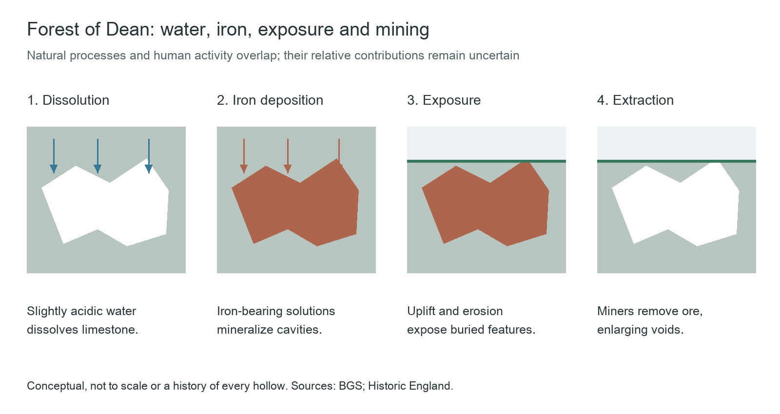
Diagram: The Daily Backstory, based on the British Geological Survey and the regional archaeological research framework. Not to scale or a precise history of every hollow.
That overlap helps explain the photograph's strange geometry. Geological structures and the routes people took to reach ore occupy the same ground. A visitor follows one path through several kinds of time.
Three Jars and a Footpath
Puzzlewood's official account supplies a more sharply dated episode. In 1848, workers found three earthenware jars in a cavity among the rocks. They contained about 3,000 Roman-era coins. The account does not resolve who hid them or why they were never collected.
The walking paths are much younger. During the nineteenth century, a landowner laid out more than a mile of them for family and friends. The woodland opened to the public in the early twentieth century.
Its rock walls, bridges and winding paths now serve another purpose: film locations. Productions including Star Wars and Doctor Who have used the site. A camera does not have to travel far here to suggest another world.
The claim that Puzzlewood inspired Tolkien's Middle-earth forests is more elusive. The woodland's own article describes it as a rumour. It cannot supply a missing scene in the writer's creative life.
The Same Opening, a Different Ending
The karst landscapes of Guilin, Yunnan's Stone Forest and Guizhou offer a Chinese counterpart to the opening act: water dissolving soluble rock. Caves, depressions, fractures and pillars can record different stages of that process.
The comparison needs a boundary. The Forest of Dean has its particular history of iron deposition and extraction. Stone Forest pillars are remnants left as surrounding rock is dissolved and removed; they cannot simply be equated with a mining landscape's trenches.
In a limestone landscape, useful questions begin with what is missing. Which spaces were once empty? Which were later filled? What has since been removed?
Puzzlewood gathers those questions beside a narrow path. We see the final shape, after water, minerals and people have each had a turn.
Sources
Puzzlewood: A peek into Puzzlewood; Puzzlewood official site; British Geological Survey: Economic minerals other than coal, Bristol and Gloucester region; Historic England: Research Framework for the Forest of Dean District (2017); BGS: Karst aquifers; Peapix: wallpaper and date cross-check.